Featured Route
Country Overview
South Africa has one of the densest networks of public unpaved road anywhere — graded gravel is ordinary provincial road here rather than a special track. The terrain changes completely across the country: the Drakensberg forms a 3,000 m escarpment along the eastern edge, the Karoo fills the interior with semi-desert plateau and pass-cut ridges, the Cederberg north of Cape Town is sandstone and rock, and the Baviaanskloof in the Eastern Cape is a single long traverse that riders come specifically to do.
What makes it work for a rider is that none of this is special access — the gravel is simply how you get between towns, so a route can be planned entirely on it without permits or private arrangements. The country is also the practical base for the whole region: it wraps around Lesotho completely and borders both Botswana and Namibia, so a South African trip extends naturally into all three. Distances are large, services are concentrated in towns, and the security picture varies by region enough that route choice and overnight planning deserve local advice rather than assumptions.
The Regions
The high wall of the eastern escarpment. Sani Pass climbs from the KZN side to the Lesotho border at 2,876 m — hairpins on loose rock, and the classic reason riders come here. North of it the Free State passes and the Golden Gate area give long gravel days at 1,700–2,300 m. Snow closes the high ground in winter.
The vast interior. Hundreds of kilometres of graded gravel between tiny towns, with dramatic passes cutting the escarpment: Swartberg on the R328 (gravel, and slick after rain), Ouberg climbing 820 m in 10.4 km with pitches at 1:6, and Gannaga lifting 548 m out of the Tankwa Karoo through 45 bends. Distances are long and services thin; the reward is empty road and enormous sky. Rideable most of the year, brutally hot in midsummer.
Sandstone country north of Cape Town — rough rocky tracks, dramatic rock formations, and a winter-rainfall climate that inverts the national pattern: this corner is at its best in the southern spring and autumn, and its wet season is the rest of the country's dry one.
When to Ride
South Africa sits in the southern hemisphere, so the calendar is inverted. Autumn (Mar–May) and spring (Sep–Nov) are the sweet spots almost everywhere — mild days, dry ground, open passes. Midsummer (Dec–Feb) brings heat above 35 °C in the Karoo and violent afternoon thunderstorms over the interior highveld. Winter (Jun–Aug) is cold at altitude with snow on the Drakensberg, but the Karoo and the Cape stay rideable. Note the Western Cape runs on the opposite rainfall pattern: it is wettest in the southern winter.
Regions to Plan Around
- →Drakensberg escarpment — Base in the KZN midlands and work north along the escarpment passes, with Sani Pass as the obvious high point and Lesotho a border post away. 3–6 days. Best Mar–May and Sep–Nov.
- →Karoo crossing — Cut the interior on gravel between the small towns — long, empty days with big passes breaking up the plateau. 4–8 days, and the section where fuel planning actually matters. Best Apr–May and Sep–Oct.
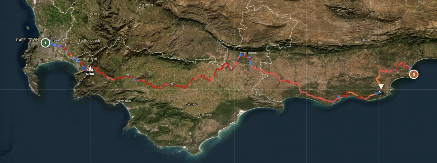
- →Cape and Cederberg loop — Cape Town as the base, north into the Cederberg sandstone and east through the Cape folded mountains. 3–5 days on rocky tracks and mountain passes. Best Sep–Nov and Mar–May.
Practical
Towns and main routes are well served. The Karoo and Northern Cape run long between stations and fuel planning is the part of the day that actually matters — fill in every town rather than at every second one.
South African rand (ZAR). Cards work in towns and at fuel stations; carry cash for small settlements, farm stalls and campsite fees.
Inside the SACU customs area, so no carnet is needed at a land border — a temporary import permit is issued at the post. The same entry carries on into Lesotho, Namibia, Botswana and Eswatini.
Municipal campsites, farm stays and guesthouses across the country. Wild camping needs the landowner's permission — almost all land here is fenced and owned, including what looks empty.
Good along main routes and in towns, thin in the Karoo interior and in mountain valleys. Download the map and carry the GPX; a satellite messenger earns its place on remote gravel.
Karoo summers pass 35 °C and the interior highveld gets violent afternoon thunderstorms. Winter is the opposite problem: sub-zero nights and snow on the Drakensberg escarpment.
Plan a South African gravel route
Set your start in Cape Town, Johannesburg or the KZN midlands and let GoraAdv route you onto the gravel network instead of the N-roads.
Open the Planner →