Featured Route
Why Adventure Riding in Bolivia
Bolivia is the highest country in the Americas. La Paz sits at 3,640 m, the altiplano plateau west of the Andes baselines at 3,800–4,500 m, and 5,000+ m passes are unexceptional. The country splits into three radically different geographies: the western altiplano (high cold dry plateau between two Andean cordilleras), the Cordillera Oriental dropping east into the cloud-forest Yungas, and the lowland eastern half (Santa Cruz, the Chaco) running into Brazil and Paraguay. The road network is the lightest of any major South American country — paved highways are rare outside the La Paz–Santa Cruz corridor, and everything else is dirt of one form or another.
Bolivia is the rawest ADV destination in South America. Offroad density per km² is among the highest anywhere on earth — 90%+ offroad routes are normal, not exceptional. The trade-off is real: brutal altitude (you're above 4,000 m for days at a time), brutal cold at night (sub-zero overnight at altitude even in summer), sparse fuel, and the kind of remoteness where breakdown without a satellite messenger is a genuine emergency. Bolivians are friendly but reserved; the Aymara and Quechua cultures of the altiplano towns hold a depth and quietness you won't find further north.
The Zones
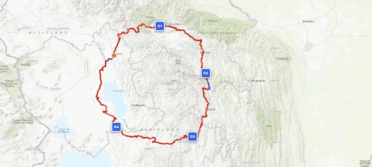
The high cold dry plateau between the Andean cordilleras. Salt flats (Salar de Uyuni at 3,656 m), endless dirt grids, llama herds, adobe villages. Fuel is in towns only — distances between are 100–250 km. Best riding May–Sep when nights freeze but days are clear and tracks are dry.
The eastern range of the Andes drops vertically into the Yungas — the Bolivian cloud forest. Passes above 5,000 m, 3,000 m descents on dirt switchbacks, the original "Death Road" (now a tourist track) and a dozen lesser-known equivalents. Some of the most dramatic motorcycle terrain on the planet.
The middle-altitude valleys around Cochabamba and Sucre (2,500–3,200 m) are where Bolivians actually live in numbers — warmer, fertile, with more amenities. Push further east and you're in the Chaco lowlands toward Paraguay, hot and flat with sparse but ridable tracks.
When to Ride
Bolivia's dry season runs May through October — the standard window for the altiplano and Cordillera. Days are clear and warm, fords are crossable, tracks are dry. Nights freeze at altitude even in midsummer (June–August can hit −10°C overnight at 4,000 m). The wet season (Dec–Mar) turns altiplano dirt to deep clay and floods the salar; many passes shut. April and November are the shoulders — dry season starting/ending, manageable but unpredictable. The Yungas and the eastern lowlands are wetter year-round; visit in the dry season for the cleanest cloud-forest descents.
Regions to Plan Around
- → La Paz altiplano loop — La Paz as base, ride south through the altiplano via Oruro, Uyuni and Tupiza. 7–10 day window, classic South America bucket-list ride. Acclimatize 2–3 days in La Paz before going higher.
- → Cordillera Oriental drop — Cross from the altiplano east into the Yungas via the high passes. La Paz to Coroico is the famous descent; Sorata and Sajama also have extraordinary drops. 3–5 day immersions.
- → Sucre & Tupiza highlands — Mid-altitude valleys (2,500–3,500 m), warmer than the altiplano with extensive dirt-track networks through canyons and pre-Inca sites. Good shoulder-season choice when the very high country is borderline.
Practical
Stations dense in cities, sparse in the altiplano interior — plan 200+ km tank ranges for the long stretches. Some stations charge foreigners a higher rate ("precio internacional"); carry small US dollars as backup currency. Always top up when you see one.
Boliviano (BOB). Cards work in cities and tourist hubs (La Paz, Sucre, Uyuni); cash only everywhere else. ATMs in major towns dispense BOB and sometimes USD. Bring small denominations — change is hard to come by in altiplano villages.
Visa requirements vary by nationality — most western EU passports are visa-free for 90 days; US passports need a visa (paid on arrival or in advance). Vehicle import via TIP at land border, valid for the same period as your stay. Insurance from a Bolivian provider; arrange at the border.
Cities and tourist towns have hostels and small hotels. Rural altiplano relies on basic alojamientos — simple, cheap, sometimes no heating. Wild camping is fine in remote areas but cold; sub-zero nights at altitude even in dry season. Pack a 4-season sleeping bag.
Coverage is spotty outside cities. Altiplano interior, Cordillera Oriental and Chaco have hundreds of km without any signal. A satellite messenger (Garmin inReach or similar) is not optional for solo riding here — there are stretches where you're a multi-day walk from the nearest help.
Bolivia is the highest country you'll likely ride. La Paz sits at 3,640 m, passes routinely top 4,500 m, and the altiplano baselines at 4,000 m. Acute mountain sickness is common — acclimatize 2–3 days in La Paz before heading higher. Carry coca leaves or acetazolamide. Cold compounds the altitude effect; pack proper layers.
Plan an altiplano crossing
Set your start in La Paz or Oruro and let GoraAdv route you across the highest dirt network in the Americas. Acclimatize first, then point the bike at the horizon.
Open the Planner →