Featured Route
Why Adventure Riding in Greece
Greece punches far above its reputation as a package-tour destination. The interior is a maze of mountain ranges — the Pindus spine running north-to-south, the Agrafa wilderness in the center, and the Peloponnese highlands to the south — all connected by gravel forest roads and shepherd tracks that see almost no motorcycle traffic. The landscape is alpine where you'd expect Mediterranean, with high passes and cool air even in summer.
The combination of dramatic altitude (peaks over 2,000m), exceptional track quality for a Balkan country, and absolute solitude makes Greece one of Europe's best-kept offroad secrets. You'll ride through beech forests, across alpine meadows, and over stone passes with panoramic views few people ever see. Road conditions are surprisingly good — the tracks are wide and graded, unlike rougher Balkan alternatives — which means you can push pace and distance without punishing your bike.
The Regions
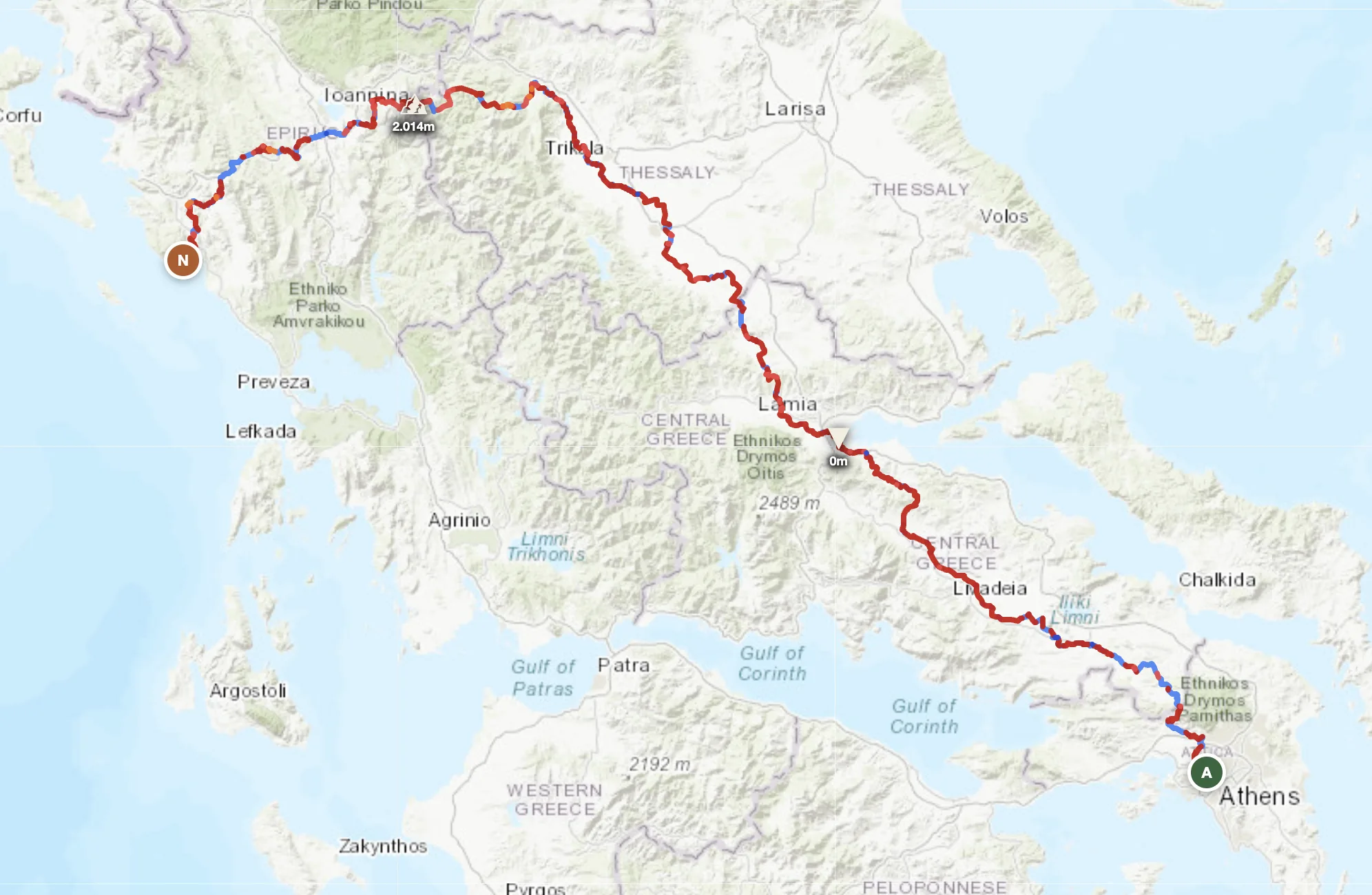
Mainland Greece's mountain spine. The tallest, most remote, most dramatically alpine. Passes above 1,800m require June–October windows. Home to the featured traverse and the highest, longest, most challenging offroad options.
Central Greece's wilderness plateau. Less dramatic than the Pindus but equally remote. Forest tracks wind through beech and pine. Broader valleys, more shepherd villages, and slightly easier logistics than the far north.
Southern mainland and islands. Lower altitude than the north but equally rugged with gorges, limestone plateaus and coastal hinterland. Season extends into May and October. Gateway to Crete if crossing via ferry.
When to Ride
Spring and autumn are the sweet spots. April–June is ideal: the snow is off the high passes, the tracks are firm, temperatures are 15–25°C in the mountains and the light is exceptional. July and August are hot — 35–40°C in the valleys, and the Agrafa dirt tracks bake hard, which is fine for riding but exhausting by early afternoon. September and October bring cooler air, empty roads and the first autumn colour on the beech forests. The mountain passes above 1,500m can get snow from November — the high-altitude sections of both routes should be avoided December through February.
How to Fit It Into Your Route
- Pindus north-to-south traverse. A 3–5 day immersion through Greece's highest mountain spine. Enter from Albania or North Macedonia, cross the main Pindus ridgeline, and exit toward the Agrafa or Peloponnese.
- Agrafa wilderness loop. Start in Karpenisi or Lamia, ride the remote central plateau tracks, and return — a compact 2–3 day option with exceptional solitude and fewer high passes.
- Albania → Greece → Turkey mountain chain. Cross from north Albania south through the Pindus, drop through the Peloponnese, then eastward into Turkey — tying three countries across the Eastern Mediterranean rim.
Practical
Sparse in the Agrafa and Pindus interior. Fill before entering any highland corridor — Karpenisi, Trikala and Lamia are the key refuel points. Gaps can exceed 100 km on remote passes.
Greece uses the euro. Cards are accepted in towns. Mountain villages, small fuel stations and rural tavernas are often cash-only — carry euros before heading into the highlands.
Schengen borders with Albania, North Macedonia, Bulgaria and Turkey. Greece is in the Schengen zone; passport control applies at non-EU borders (North Macedonia, Turkey).
Karpenisi is the best mountain base. Kastoria, Trikala and Lamia offer full amenities. Small guesthouses exist in most villages on major routes.
Good on coast and towns, absent in deep gorges and high passes. Download offline maps before entering any highland corridor.
Highlands stay 12–20°C in summer. Valleys and lower elevations reach 30–40°C July–August. Above 1,500m nights can drop below freezing even in June.
Plan an offroad route in Greece
Set your start and end — GoraAdv finds the most offroad line through the mountains. Adjust, calculate, export GPX.
Open the Planner →