Featured Route
Why Adventure Riding in Norway
Norway is a vertical country. The Scandes run its full length, separating the fjord coast from the forested east, and inland the Hardangervidda and Jotunheimen massif hold Europe's largest high-plateau wilderness — bare rock, lichen, summer snow, and a gravel network built for hydro dams, grazing and forestry. Sightlines are wide, fences are rare, and the allemannsretten right-of-access lets you camp almost anywhere you please.
The price of admission is the season. The core window is narrow — June to September — and weather inside it still shifts fast: rain, fog and temperature drops above the tree line are normal, not exceptional. What you get in return is scale. Days of gravel without a junction, passes that sit above the snowline in midsummer, and a sense of emptiness you won't find anywhere else in Europe.
The Regions
Norway's alpine core. Home to Galdhøpiggen (2,469 m), the country's highest peak. Gravel and unpaved toll roads climb between ice-carved valleys, glacial lakes and alpine huts. Short season — late June through early September only.
Europe's largest high mountain plateau. Vast, treeless and wind-scoured. Most of it is a national park with limited motorised access, but connector gravel on its edges and the RV7 corridor define the feel of crossing it.
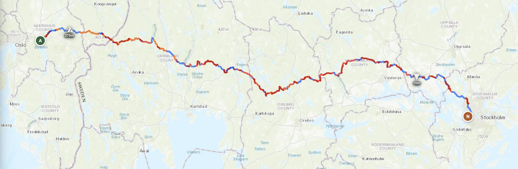
Rolling forested uplands along the Swedish border. Lower altitude than the Jotunheimen passes but denser gravel networks and longer rideable season — useful in May or October when the high passes are closed.
When to Ride
June to September is the window. Mountain passes above 900m can hold snow into late May and close again in October — the Jotunheimen area specifically. July is peak season with the best weather but also the most traffic on the few paved roads. September brings quieter roads, autumn colour and cooler but still reliable conditions. Avoid everything outside this window for mountain routes — Norwegian highland gravel in winter is ice and snow, not passable.
How to Fit It Into Your Route
- Norway → Sweden Nordic loop. Cross east from Trøndelag over the Scandes into Jämtland, ride Sweden's forest roads south, and re-enter Norway via Värmland to close the loop.
- Coast-to-inland traverse. Start on the Oslofjord, ride inland through Innlandet's gravel networks into Jotunheimen, then drop west toward the fjord coast at Sogn og Fjordane.
- Sweden → Norway → Finland arctic push. Cross from northern Sweden over the Scandes into Trøndelag or Nordland, then east along the Arctic Circle corridor into Finland's lake country.
Practical
Good coverage along main valleys. In the highlands gaps can reach 100+ km. Fill up before heading onto the plateau — mountain service stations are rare and often unmanned card-only pumps.
Norwegian krone (NOK) — Norway is not in the EU. Card payments work almost everywhere; cash is rarely needed. Fuel and food are noticeably more expensive than the EU average.
Schengen — open land borders with Sweden and Finland. The only non-Schengen land border is Russia in the far northeast, which is closed to tourist traffic.
Allemannsretten (right-to-roam) makes wild camping on uncultivated land legal. DNT mountain huts are bookable across the country. Book regular accommodation ahead in July.
Good in valleys and along the fjord coast. Dead zones in the highland interior and on the plateau. Download offline maps before leaving the tree line.
Coastal summers are mild (15–22°C). Above 1,000 m, day temperatures sit around 8–15°C and nights can drop below freezing even in July. Plan for rain, wind and abrupt shifts.
Plan an offroad route in Norway
Set your start and end — GoraAdv finds the most offroad line through the mountains. Adjust, calculate, export GPX.
Open the Planner →